Oct 22 2007
Archive for the 'Mapping' Category
May 08 2006
New RAC Map
I wanted to make a map of the ride that uses real GPS data and would work with just a web browser and not require Google Earth.
Check this out:
http://www.declan.net/wp-content/gpx_loader.html
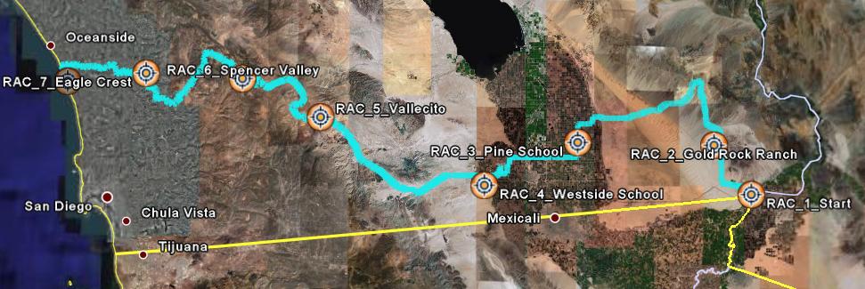
This uses Google maps with an overlay of the route we took. The data comes from a rider’s GPS device, so it is very accurate.
All of the roads we took are marked and you can zoom and pan over the whole ride. Click on Satellite view or Hybrid to get a neat view of some of the terrain.
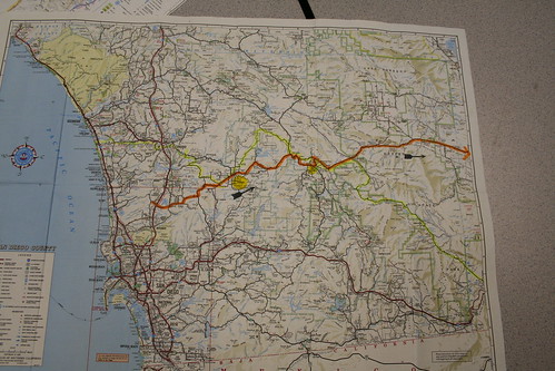
Apr 24 2006
Ride Across California GPS Based Google Map
I made some maps earlier based on the chase drivers maps. This map comes directly from the tracks files from a GPS one of the Dads had on the ride, so it is totally accurate.
Here are the data files so you can play with them yourselves:
KMZ File – works with Google Earth
GPX File – GPS eXchange Format
GDB File – the base Garmin DataBase that came from the device
Apr 24 2006
Ride Across California Elevation Chart
I received great GPS data from some of the guys who had devices on the ride. I was able to make elevation charts. Someone with more patience can figure out our total climb. Here’s the whole 267 mile ride as one chart (note that the scale changes on the Day charts, so they are not directly comparable):

Day 1 – River to Gold Rock Ranch:

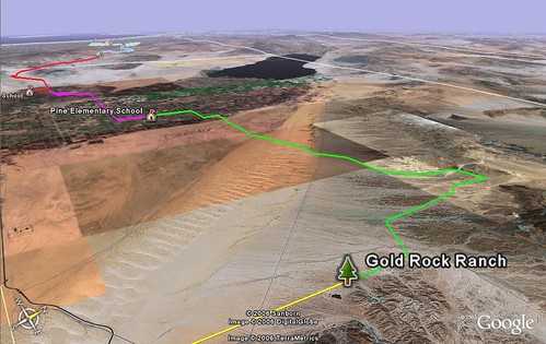
Day 2 – Gold Rock Ranch, across the Dunes, to Pine School:

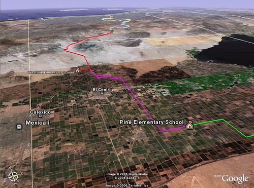
Day 3 – Pine School to the El Centro pool, to Westside School:

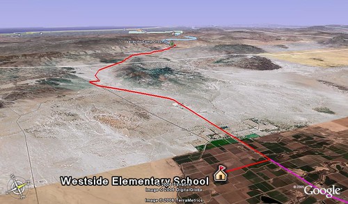
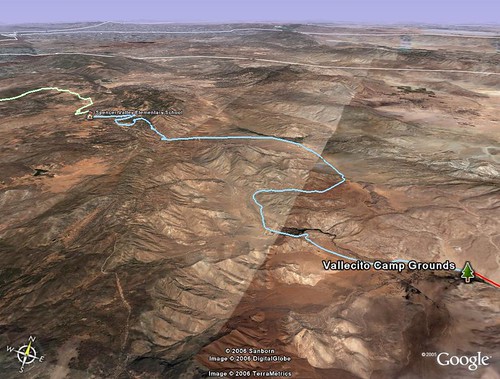
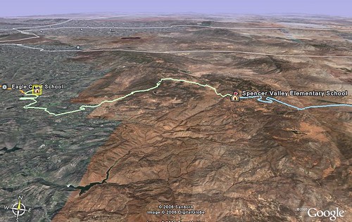
Day 4 – Westside School, through Plaster City, to Vallecito Camp Ground:

Day 5 – Vallecito, up Banner Grade, to Julian and Spencer Valley School:

Day 6 – Spencer Valley School, through Black Canyon, to San Pasqual School:

Day 7 – San Pasqual, to yummy breakfast, to the coast!

Apr 16 2006
Ride Across California Map Geeking
If you’re new to this site, I’m a map geek. Combining this sickness with next week’s RAC, below are some views of way too much time spent in Google Earth.
If you are interested in seeing the source files and playing with the maps yourself, download the free Google Earth here, then grab all the .kmz files.
Here’s an overview of the whole ride. Each color is a different day:
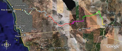
Here are the individual days:
Day 1:

Day 2:
Day 3:
Day 4:
Day 5:
Day 6:
Day 7:

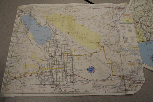
Apr 14 2006
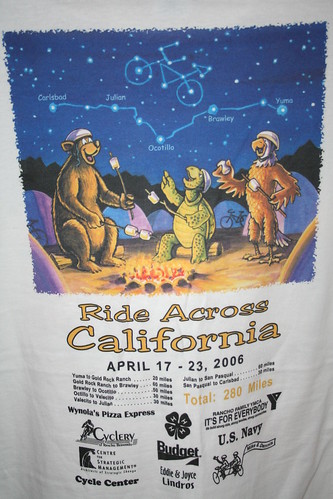
Ride Across California
Erin’s 5th grade class trip over spring break next week is a Ride Across California. We start in Yuma on Monday, then ride and camp our way to Carlsbad by Sunday. Here’s a low tech map of the ride:
This is a little better:
Here’s our model:

I’ll try to blog on the trip, but I don’t know about Internet connectivity in the cacti.
Me, Erin, 75 ten year olds… I know how to spend a week off, baby! 🙂
Nov 09 2005
Escondido North Bike Ride
Here’s the ride we did this weekend:

Here’s a Google Earth .kmz file for the Escondido North ride this weekend.
Sep 03 2005
Katrina Google Earth Overlay
I grabbed DigitalGlobe’s Aug 31st New Orleans sat image and laid it down on Google Earth: